Thursday, June 30, 2011

40. Arid Environments and Wind as a Geomorphological Agent

Photo 70: Sand Dunes in the Rocky Mountains close to Jasper, Alberta. 2011-05-19

Aeolian Processes

After water, karst, and glacial erosion, it is important to look at wind as erosional force. Wind sets in motion grains of sand and clay, which can erode surfaces in the case of wind abrasion (sandblasting) and can form landforms and landscapes during surface creep (in the case of larger particles and rocks) and deflation (in the case of fine particles). Wind is only an erosional force when it picks up grains of sand. Some main landforms of wind erosion are yardings, aerodynamic ridges in rock parallel to the main wind direction, and ergs, which are aggradational sand seas in desert areas that contain about 95% of all Aeolian (wind-related) sand.

Sand Dunes

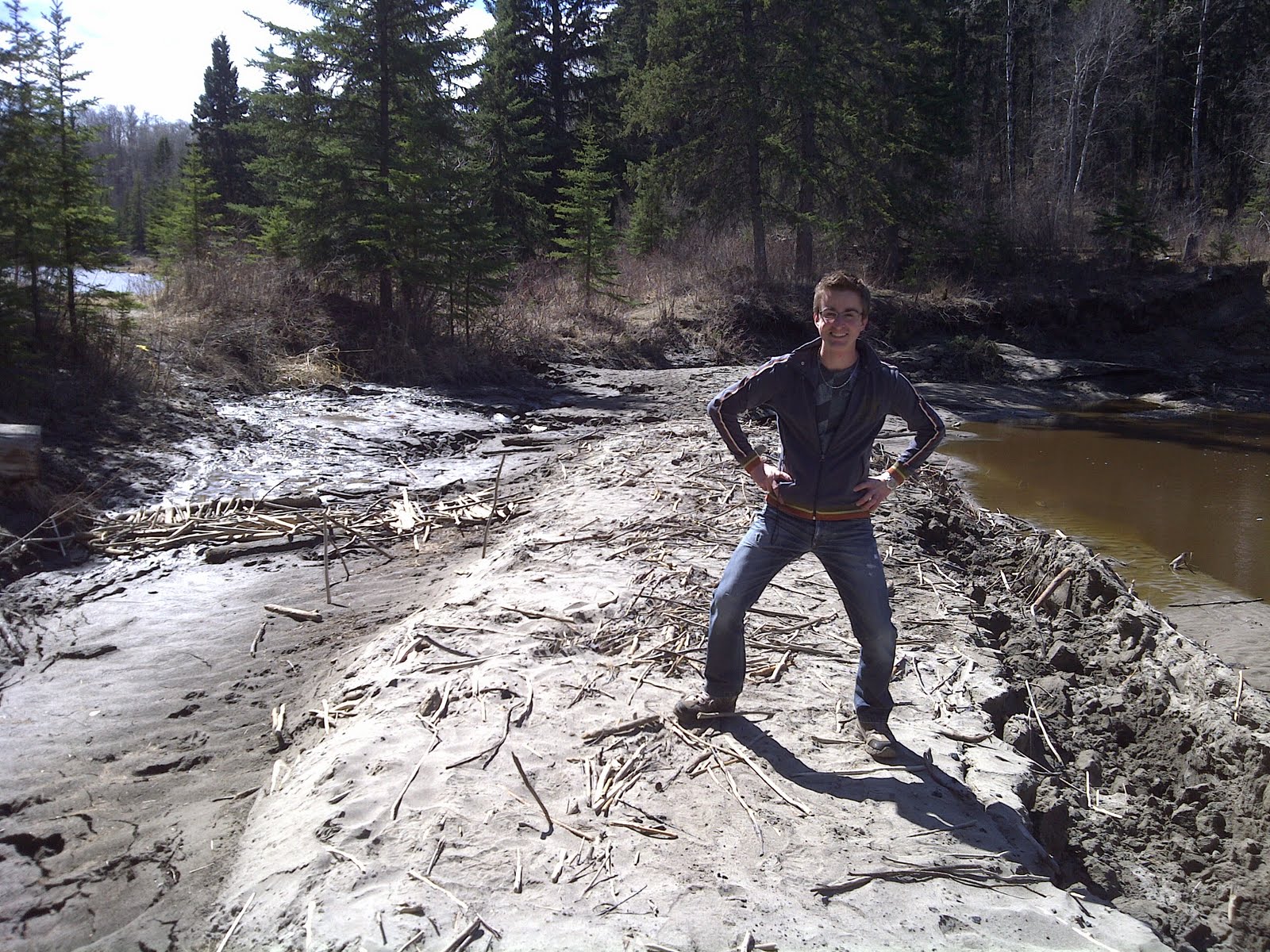
Photo 70 shows, to my surprise, sand dunes in the Rocky Mountains. Dunes are aggradational landforms of deposited sand. Deflation moves sand and finer particles. When sand reaches the impact threshold, it bounces back into the air, thus being able to travel great distances. Sand accumulates in areas of slower wind speeds and around existing landforms. In photo 70, the sand dunes are formed against the windward side of a mountain. Sand dunes themselves have a windward side too, called backslope, a top or crest, and a leeward side or slip face. Photo 71 shows an Aeolian feature called blow-out, where the wind has carved the surface in a way that is like a Barchan dune.

The sand dunes in the location of the photos are fed by the river across the road, which is full of water during spring runoff and quite empty during fall and winter. Sand from the river’s bed has formed the dunes, in combination with the wind. The wind is aided by the surrounding landforms (mountains) that have directed the wind in a favourable way for dune formation.


Photo 71: Blowout in Sand Dunes. 2011-05-19

37. Landforms and Landscapes of Continental Ice Sheets and Mountain Glaciers

Photo 65: I visited Moraine Lake, Alberta, which has interesting land forms due to glacial deposition. 2011-06-20

Glacial Deposits

Glaciers form landform and landscapes. One of the ways is through deposition. Water under the glacier transports sands and gravel, wind above the glacial terrain transports sand and clay, and the glacier itself makes ice-deposits. These deposits are called till. Rock-deposition that is carried at the base of a glacier is called basal (lodgement) till and rocks carried on top is ablation till. That these rock deposits can be significant is visible in photo 65, at Moraine Lake, close to Lake Louise. The rock pile in the photo is mostly due to ablation till, because the source of the rocks is the landslide visible on the right side of the photo. The lake in the foreground is the former location of the glacier.


Photo 66: Medial Moraine. 2011-05-18

Moraines

Photo 66 shows a medial moraine of the Athabasca glacier, formed in 1908, as this receding glacier came temporarily to a stand-still. Medial moraines are also called recessional moraines. Due to the glaciers continual deposition and the glacier’s stand-still, a little wall of rocks and sand is formed. A glacier has one terminal moraine, a line of rock deposits marking the farthest point of the glacier. As a glacier recedes, it may leave a layer of deposits on the receding surface, called ground moraine. Photo 67 shows rock worn out by the Athabasca glacier as well as ground moraine deposits. 


Photo 67: Glacial friction erosion as well as ground moraine deposits at Athabasca Glacier. 2011-05-18

Photo 68 shows the southern lateral moraine of the former side of the Athabasca glacier. 

Photo 68: Lateral Moraine. 2011-05-18

Photo 69 shows the northern lateral moraine of the Athabasca glacier, up to about the height of my left hand, and above it neighboring Dome glacier coming over top of the moraine, with its southern lateral moraine slightly visible as the black rocks on top of the ice cap.

Photo 69: Lateral Moraine. 2011-05-18

36. Glacial Degradation and Aggradation

Photo 63: Athabasca Glacier, Alberta. 2011-05-18

Cryosphere

In the previous posts I have talked about the hydrosphere and the oceans, about the lithosphere and how rocks and rivers work, about the atmosphere and weather, little bits about the biosphere, and now it is time for the cyrosphere, the sphere of frozen water.

Athabasca Glacier

Photo 63 is the well-known Athabasca Glacier, feeding the Mackenzie river-basin, which eventually flows into the Arctic Ocean. A glacier is a body of ice, formed on land, and is always in motion. Mountain glaciers, like those in the Rockies and Alps, are located in valleys with sometimes steep slopes. Contrary, continental glaciers are not confined by a valley: for example the ice cap of Antarctica and Greenland.

Glacial Processes

Glaciers consist of compacted snow. As snow falls, it is compacted due to gravity and slightly melts in summers, thus creating a hard layer of ice. A glacier is an open system, which means it is not self-regulating but it is influenced by forces from outside. Glaciers are fed by new layers of snow in the zone of accumulation, which is usually the top of a glacier. Glaciers loose ice at the bottom, which is the zone of ablation.

Cirque

Some glaciers form in a cirque (or corrie), as show in photo 64. A cirque is a relatively flat shelf on a steep slope. Some cirques have a small lake in them and others permanent glaciers. Cirques often form, like in photo 64, because ice and snow converge from three directions. This creates erosional forces that often enlarge a cirque.

Photo 64: A cirque glacier in Jasper National Park. 2011-05-18

35. Karst Processes and Landforms

Photo 59: Maligne Canyon, Jasper national park, Alberta. 2011-05-19

Karst

This geographical feature is named after the Kras Mountain range in Slovenia. Karst landscapes are distinctive, associated with underground chemical weathering and erosion. So it is water that ‘eats’ away rock, particularly soluble limestone bedrock; it is the chemical process and not the frictional process that is most significant in Karst erosion. In the post on Unit 23, I explained that limestone is a sedimentary rock, i.e. compressed and cemented sediment. Photo 59 of the Maligne Canyon near Jasper, Alberta, is a good example of Karst at work.


Photo 60: Maligne canyon, dried up canyon branch. 2011-05-18

Maligne Canyon

Maligne canyon is an active Karst system with open and closed cave systems. The erosion rate is less than 1 mm per year. Maligne canyon is millions of years old and has served as a river underneath multiple glaciers. Photo 60 shows that the canyon is not static: this passageway was once part of the canyon's water stream, but now it is dried up because the water has taken a different route. The sides of the passageway are beautifully eroded.

The canyon has been formed by various processes:
·         Biological activity like tries growing on the side of the canyon help to break down the rock sides.
·         Mechanical weathering causes rock to crack due to temperature changes in the rock.
·         Dissolving of the limestone rock in the canyon is due to water flow (karst).
·         Frost shattering occurs when water in rock-cracks freezes and expands.
·         Corrasion is the erosion of rock by means of sand and gravel, which grinds away rock.


[photo removed]

Photo 61: Karst cave near Cancun, Mexico. 2008-12-18


World-wide Karst systems

Karst systems in the Alpine areas are located at very high altitudes and form deep cave systems. Karst systems in the temperate regions have a mix of surface streams and underground streams as well as cave networks, like those in Slovenia. Tropical karst develops faster and has larger features due to the higher levels of rainfall in the tropical climate regions. Caribbean karst is found in flat areas and contains underground springs and large caves. Photo 61 shows the inside of one of those Caribbean caves. The water in this cave is fed by an underground cave-river system and probably also underground springs.


Photo 62: Sinkhole at Buffalo Jump, Alberta. 2011-05-12

Sinkhole

I have quite a few images for this unit. One other Karst feature I would like to discuss is the sinkhole. The temperate Karst system steams have the characteristic of disappearing into the Earth. Photo 62 shows a dried-up sink hole at Buffalo Jump, Alberta. These sinkholes are sometimes also referred to as swallow holes.


34. Aggradational Landforms of Streams

Photo 57: Meandering river at Buffalo Jump in the badlands of Alberta. 2011-05-12


Meandering Rivers

Photo 57 above shows a clear meandering river, which is a river path with many curves and bends. Water flows to the lowest spot, which determines the path of the river. This is called channel habit. This habit or path of the river is influenced by the amount of discharge, amount of sediment in the river, type of sediment, and the channel gradient (slope). Meanders probably form due to the uneven terrain. Once meanders are formed, they often widen due to deposition in the inside corners of the curves and flood plains and erosion on the outside of the curves.


Photo 58: Oxbow Lake, Whitemud Creek, Edmonton, Alberta. 2011-05-04


Oxbow

The fieldtrip to the Whitemud Creek oxbow was highly interesting (photo 58). Meandering rivers and streams often widen their curves over time. Large meanders almost cause the snake-like-trail of the stream to touch itself, and sometimes it does, as the curves of the meandering river continue to widen. This creates a shortcut in the stream’s flow. Because a straight path down is the quickest and has the highest gradient, the straight path is used more frequently than the former curving course of the stream. Over time, this curve is separated from the stream due to deposits at its openings. This separated curve, a former piece of the stream or river, is called an oxbow. Photo 58 shows the current path of the Whitemud Creek on the right and the oxbow in the top-left corner of the photo.

32. Slopes and Streams

Photo 55: The junction of Whitemud Creek and Blackmud Creek. Edmonton, Alberta. 2011-05-04

Rivers

Photo 55 shows the joining of Edmonton’s Whitemud Creek and Blackmud Creek, to continue as the Whitemud Creek. In this case, the Blackmud Creek is a tributary of the Whitemud Creek. Rivers start as rain on a field, flowing towards the lowest area, which is called sheet flow. Too much sheet flow or sheet wash can cause sheet erosion, the removal of the nutrient-rich topsoil. Sheet flow accumulates into small channels called rills, which merge into gullies, and gullies into streams. The Whitemud Creek tributary drains into the North-Saskatchewan river, which can be labeled as a trunk of the Saskatchewan river watershed. The system of trunk and tributaries is called a drainage basin or watershed. The Athabasca glacier and river, discussed in a few other blog posts, drains into the Mackenzie River drainage basin. Drainage basins are separated by continental divides, high continual ridges in the continent that determine water flow.


Photo 56: Various rocks, eroded through various processes, at our new pond behind our house. Lacombe, Alberta. 2011-06-26

River transportation

Photo 56 shows the recently built pond in our back yard. We used some rocks from our agricultural fields, the rocks with sharp corners, which over time make their way to the surface of the land. The other rocks in the photo are round and have probably been transported by rivers. Rivers transport sediment of many varieties. Clay, silt, and sand are often suspended in the water due to the river’s velocity. These materials are also most easily deposited. Rocks are pushed along by rolling over the river’s bed (bottom), which is called traction. Lighter rocks are sometimes suspended and roll at other times, they jump through a river, which is called saltation.

31. Water in the Lithosphere

Photo 53:Waterfall in the Kananaskis area, Alberta. 2010-07-28


Streams and Rivers

Water is part of the Hydrologic Cycle, as discussed in the post on Unit 11. Once water enters the lithosphere, water is stored and transported in various ways. The driving force of transportation is gravity. “All streams run into the ocean, yet the ocean is never full,” so goes the ancient saying from the Tao Te Ching. This saying refers to the abundance in humbleness; to be like the ocean is to be below all other things, yet receive everything.

Photo 53 shows a beautiful waterfall, one of many in the Rocky Mountains. Streams and rivers are a major transporter of water. The amount of water that passes through a river, the discharge, depends on the gradient and on the source feeding the river. Discharge is measured in a hydrograph. In Alberta there is much seasonal variation, many streams dry up in the after the spring stormflow runoff. Other streams and rivers maintain a constant baseflow.

Surface Retention

Before water enters streams and rivers, it is held on and in the Earth's surface. Canopy interception occurs when vegetation holds water that evaporates before penetrating the soil. Water is absorbed by the soil during infiltration, as well as held in cracks and puddles, which is called surface retention. When these storage places are saturated (when the field capacity is reached), runoff occurs above and in the soil. Groundwater is stored in the zone of aeration, or vadose zone, just below the surface of the land, as well as in the zone of saturation, or phreatic zone, deeper in the Earth’s crust. The process of water passing through soil and rock is called percolation (like a coffee precolator). Porous layers of rock that can hold water are called aquifers.


Photo 54: Eutrophic disconnected oxbow arm, Whitemud Creek, Edmonton. 2011-05-04

Lakes

Where the water table below ground intersects the land surface, a lake, spring, or wetland appears. Lakes also form in low areas where infiltration, stream runoff, or evaporation is not able to transport all the water. Canada has 60% of all the world’s lakes. Lakes are classified in 4 categories based on nutrient content:
·         Oligotrophic lakes are clear but nutrient poor with very few types of organisms
·         Mesotrophic lakes are clear and have an average level of nutrients, mots lakes are Mesotrophic
·         Eutrophic lakes are nutrient rich with many plants and some algae
·         Hypertrophic lakes are excessive in nutrient content, lack oxygen, dirty water, and a many algae. This is often the cause of agricultural runoff or municipal sewerage.
Photo 54 is a former oxbow, which is now a horse-shoe shaped pond with no active river flow. This stale water falls in the Eutrophic category.

28. The Formation of Landscapes and Landforms

Photo 51: Landscape at Abraham Lake, Alberta. 2011-05-18

Landscapes and Landforms

A landscape is a combination of many landforms. Landforms are the individual defining features of a landscape. Landforms are formed through folding, faulting, tilting, and warping of the earth’s crust, often due to earthquakes and volcanic activity. The results of these forces are called primary landforms. Weathering and erosion shape landforms in defining ways, resulting in what is called secondary landforms. Photo 51 shows a beautiful landscape, filled with primary landforms, the Rocky Mountains, as well as a secondary landform, the Lake. Although lakes and streams are often naturally created secondary landforms, Abraham Lake is partially artificially created by humans.

Degradation and aggradation.


To create secondary landforms, some areas are worn and weathered away in the denudation or degradation process. In other areas, sediment is added to the existing strata in the aggradation process. Flood plains and river deltas are good examples of aggradational areas. Erosion is an important degradational force that defines a wide variety of processes: running water (see posts on Units 31, 32, 34), glaciers (see posts on Units 36, 37), wind (see post on Unit 40), coastal waves, and chemical dissolution (see Karst post on Unit 35). Buffalo Jump in the Albertan Badlands (photo 52) is the place where North-American natives used to chase buffalos of a steep cliff.  Photo 52 shows very clear water erosion in these soft sedimentary rock layers.

Photo 52: Obvious signs of water erosion, creating art-like nature, at Buffalo Jump, Alberta. 2011-05-12

27. Surface Expression of Subsurface Structures

Photo 49: Fold structure at Abraham Lake, Alberta. 2011-05-18

Fold Structures


When rocks are under a lot of stress, due to plate movement or otherwise, they can respond by bending or breaking (see post on Unit 26 for faulting). Folds are bended earth-layers or strata. All rock bends, but sedimentary rock strata bends easier than for example igneous granite. Faulting and folding often occurs together. Photo 49 displays a clear cut through of a syncline, the downfold. The upfold, or hill, of a fold is called anticline. Over time, these fold structures erode; the crests of the anticline become flatter and the valleys of the syncline fill in with new sediment. In a natural situation, the upper soil layer in a syncline is therefore often younger than that of the anticline.


26. Earthquakes and Landscapes

Photo 47: A fault in the rock (left of the tree) at Maligne Canyon, Jasper National Park, Alberta. 2011-05-19


Earthquakes

Colliding lithospheric plates cause earthquakes. The seismic waves of these quakes travel throughout the lithosphere and upper mantle of the earth, causing dislocated strata, open fractures, scarps and lines of crushed rock. Earthquakes can also cause mudslides, Tsunamis, snow avalanches, and rock avalanches like in the former town of Frank, Alberta (photo 48).

Epicentre is a well-known term, but this actually represents the spot on the Earth’s surface right above the focus point (origin) of the earthquake, and is not itself the point of the earthquake. The magnitude of an earthquake is measured by a seismograph and based on the Richter scale. This is a logarithmic scale invented by the American seismologist Charles Richter in 1935.

Fault Line

Photo 47 displays a fault line, to the left of the tree. The fault line in this rock might have been caused by water expansion as it froze during the winter. A fault line is a key term in regards to earthquakes as well. It marks a breaking point of the crust, where the plates on both sides of the fault line don’t move together in the same direction. Rocks have certain plasticity and will deform slightly before breaking. At the breaking point, the rocks will snap back into their original form and cause an earthquake. The fault plane is the plane of contact between 2 planets. The fault scarp is the side of the higher plate, visible with vertical plate movement. The fault trace is the line of debris along the fault line on the lower one of the two plates.

Photo 48: The site of Frank slide, Alberta. On April 29, 1903, at 4:10 am, a wedge of limestone over 1 km wide, 425 m long
 and 150 m deep broke of the top of Turtle Mountain. In 90 seconds the town of Frank was covered with rocks, some
still quite large as the photo shows. Few inhabitants of the town survived. 2009-09-07

24. Lithospheric Plates and Plate Movement

Photo 43: Plate movement of the Earth, Tyrrell Museum, Drumheller, Alberta. 2011-05-12


Pangaea

Nearly a century ago, Alfred Wegener already hypothesized continental movement and an initial supercontinent. The shields of the current continents, like the Canadian shield, are the solid core of continents and maintain relative size and shape throughout time. In 1915, Wegener named this supercontinent Pangaea (meaning ‘All-Earth’). He theorized that Pangaea broke apart into the northern Laurasia (North America and Eurasia) and the southern Gondwanaland (South America, Africa, India, Australia, and Antarctica). At the Royal Tyrrell Museum in Drumheller, the exhibition showed the moving continents per era (photo 43).

Plates


The Mid-Oceanic Ridge system is a mountainous area in the middle of the Atlantic and Pacific Oceans. The mountain peaks are till about 2 km underneath sea-level, however. These mountains are unlike continental mountains. The ridge system is the result of seafloor spreading, where new continental crust is created by magma from the Earth’s upper mantle due to plates moving away from each other. These plates are called lithospheric plates and the movement of the plates is called plate tectonics. Plate margins are the places, opposite of seafloor spreading, where the plates collide. In Europe, this creates the Trans-Eurasian belt of mountains. In the Pacific Ocean, this is the ring of fire, the chain of earthquake and volcanoes along the Asian and American coasts. Japan’s recent earthquake was one in the ring of fire earthquake zone. In Alberta, colliding plates have created the Rocky Mountains (photo 44).


Photo 44: Continental convergence zone, the Rocky Mountains of Alberta. 2008-06-29

23. Sedimentary and Metamorphic Rocks

Photo 40: Limestone (Tyndall) with a marine life corpse in the rock. CIBC bank building, Edmonton, Alberta. 2011-05-10

Sedimentary Rocks

Sedimentary rock often start its existence as sand or gravel in a lake, river, or desert. Sedimentum is Latin for ‘settling.’ These fine rocks result from erosion and transportation. Sedimentary rocks come together during river deposition and later compaction (lithification) of the sediment. During compaction, the rocks and grains are tightly squeezed together. Water often runs through this material, depositing small amounts of silica and calcite. This is the process of cementation. Clastic sedimentary rocks are made up of all kinds of other rocks and rock material and encompass most of the sedimentary rock. Nonclastic sedimentary rocks are made up of organic deposition or from chemical solutions due to deposition and evaporation. Examples of sedimentary rock include: limestone (photo 40), shale, and sandstone (photo 41).


Photo 41: Loose sandstone used for cat litter, Drumheller, Alberta. 2011-05-12

Metamorphic Rocks

Metamorphic rock has been altered by heat and pressure. Metamorphic comes from a Greek word which means ‘change.’ Both Igneous and Sedimentary rocks can be melted and become metamorphic rocks. This melting happens during a comet impact or volcano eruption. One way of melting happens when lava flows out over other rocks during contact metamorphism. Some examples for metamorphic rocks are quartzite (quartz grains and silica cement), marble (from limestone) (photo 42), slate (from shale), gneiss (from granite), and schist.

Photo 42: Light coloured marble on the Toronto Dominion Bank Building during rock-walk in Edmonton, Alberta. 2011-05-10

22. Minerals and Igneous Rocks

Photo 38: The Fairmont Hotel Macdonald, with exterior cladding consisting of  Indiana limestone. Edmonton, Alberta. 2011-05-10

Minerals and Rocks

Minerals are crystalline in nature, which means that the atoms are orderly arranged. This arrangement is best seen with microscopes and X-rays; however, some crystals are naturally beautiful like diamonds. Minerals are inorganic compounds found in rock, in fact, the mineral structure is molten rock which has hardened over a long period of time underneath the Earth. Lava that comes to the surface and cools down quickly becomes rock that does not have the orderly crystalline structure. Obsidian is an example of rapidly cooled lava. Rocks and Minerals are defined by their properties in: chemical composition, hardness, cleavage/fracture, colour/streak, and lustre. Almost 75% of all rocks in the Earth’s crust are made up of Silicon and oxygen. Other common elements are Aluminum, Iron, Calcium, Sodium, Potassium, and Magnesium.

Igneous Rocks

There are 3 types of rocks: Igneous rock, formed by cooled magma; sedimentary rock (photo 38), formed by weathered igneous rock which is eroded, transported, and deposited; and metamorphic rock, which is igneous rock transformed by heat and/or pressure. Igneous means in Latin ‘born of fire.’ Intrusive igneous rocks are hardened lava in the crust; extrusive igneous rocks are hardened lava on the crust. Granite (photo 39) is an intrusive igneous rock. The larger the crystals in the intrusive rock, the slower the cooling process. These rocks with large crystals are called plutonic igneous rocks.

Photo 39: Black granite exterior surface, former building of the Imperial Bank of Canada, Edmonton, Alberta. 2011-05-10

20. Planet Earth in Profile: The Layered Interior

Photo 34: Sediment layers at Drumheller. 2011-05-12


The Earth’s Interior

Drumheller is a unique location, a valley revealing many layers of soil and rock (photo 34). Yet these layers represent a small fraction of what the Earth is made up of. The radius of our planet is 6370 km, the continental crust is on average 45 km thick, the oceanic crust about 6-7 km thick. The deepest human drilling in Russia went to a mere 12.262 km. We know about the Earth's interior through the Seismic waves of earthquakes, which reveal what the inside of the Earth is like because of the way waves hit certain rock layers.

Earth has a Solid Inner Core with a radius of 1220 km, consisting of iron and nickel in a solid state due to the enormous pressure. Going outward, there is the 2250 km thick liquid Outer Core, consisting of iron and nickel as well, but in liquid state due to less pressure. Beyond that is the Solid Lower Mantle of about 2230 km thick, consisting of oxides of iron, magnesium, and silicon. The Upper Mantle is a thin mantle of only 670 km and borders the Earth’s crust. This Upper Mantle is mostly liquid syrup like rock, which feeds the magma chambers of volcanoes and on which the continental plates move. The distinct boundary between the upper mantle and the continental and oceanic crust is called the Mohorovičić discontinuity.

Photo 35: Atlantic Ocean, France. 2005-07-03

The Structure of Oceans

Humans know quite a bit about the continental Earth, but sometimes the Oceanic realms can still hold great surprises. The Oceanic floor has many landforms similar to that of the continents. Some of the deepest oceanic parts are very close to the continents and not in the middle of the oceans: not at all what one would expect when looking out over the flat surface of the ocean (photo 35). Expanding a bit on the post in Unit 2, there are 3 main Oceanic topographical features:

·         The Mid-Oceanic Ridge are systems of mountain ranges, varying from 1000 km to 4000 km wide, in the Atlantic and Pacific Oceans. These ranges are about 50,000 to 60,000 km long, mostly a couple of kilometers under water, but sometimes form islands like Iceland and St. Helena. These mountains have rift valleys, volcanoes, and some seismic activity. The Mid-Oceanic Ridges are not mountains due to plate collision like those on land, they are the result of seafloor spreading. New magma comes up from the Upper Mantle and pushes the old aside.
·         Deep Ocean Basins are the flat bottoms of oceans, and lay between 4.5 and 6 km below sea level. Active basins expand due to plate movement; inactive basins collect sediment, like the Gulf of Mexico.
·         Deep Marginal Trenches are long and narrow trenches up to about 11 km below sea level. They are located at the edges of deep oceanic basins and near continental shelfs.

18. Dynamics of Past and Present Climate Change

Photo 31: The terminal moraine of 1908 at Athabasca Glacier: signs of global warming. 2011-05-18

Climate Change Evidence

The Earth’s climate changes slowly over time. The Earth has been covered with ice before and now some fear that most of the icecaps will melt. We know what past climates on earth have been like by drilling ice cores. Pockets of air in the ice cores are trapped since the time they got frozen over; as well, the composition of the frozen water can tell the chemical composition of the air and water at that time. Scientists can look up to about 1 million years back in time. Recently, our climate has changed at an unusually rapid rate. One sign of increasing surface temperatures is the receding Athabasca Glacier (photo 31). On our fieldtrip we came across measuring instruments that measured the water and perhaps other factors regarding the glacier (photo 32). 

Photo 32: Water testing at Athabasca Glacier, Alberta. 2011-05-18

Organizations

Governments and companies seem to take a continually more pro-active approach towards monitoring climate changes and attempting to change their conduct towards more sustainable ways of living and producing. There seems to be sharp division among scientists and organizations themselves regarding the best course of action in regard to environmental care. I have worked for a so-called 'green' company, called Carbon Busters, for about 2 years (photo 33). The director Godo Stoyke (top centre, photo 33) is one of many knowledgeable scientists concerned with the state of our planet. As rapid as the climate is supposedly changing, so equally rapid seem the changes in the ‘green’ sector. Personally, I am in favour a future where we as humans live in a way that is more sustainable, giving our children a healthy planet to live on.

Photo 33: Carbon Busters team, a company geared towards Sustainable Development 2009-09-24

16. Climate Classification and Regionalization

Climates

I have spent most of my youth, up until the age of 18, in The Netherlands. I did not go on holidays very often when I was young, but once I went to the beach of Western-France. This beach is quite similar to the beach in Holland, though the North Sea is a bit warmer than the Atlantic Ocean. These areas belong to the humid sea/ocean-climate (photo 29). When I moved to Alberta, I was met with very different weather and unusual things started to happen. My hands started drying up and my shower towel was already dry the next morning after showering the previous night. Alberta is a land-climate (photo 30). However, these names are not very official terms.

Climate Classification

The Köppen classification system is widely used. The system was invented by the Swiss botanist Alphonse de Candolle in 1874, and named after Wladimir Köppen. It was Köppen who realized that plants were an excellent indicator of climate.

Besides plants, other influential factors on climate are:
·         Latitude
·         Location compared to high and low pressure zones
·         Nearness to oceans
·         Altitude
·         Local winds
·         Distribution of land and sea, and topography of landforms

The Köppen system has the following classifications:
·         A = Humid Equatorial Climate (around the equator)
·         B = Dry Climate (e.g. Saskatchewan)
·         C = Humid Temperate Climate (e.g. The Netherlands and France)
·         D = Humid Cold Climate (e.g. Russia and North-East Canada)
·         E = Cold Polar Climate (Arctic and Antarctic)
·         F = Highland Climate (e.g. USA High Plains)


Photo 29: Ocean climate at the coast of western France. 2005-07-05


Photo 30: Horseback riding. Albertan land climate, Red Deer, Alberta. 2011-05-21